Skip to content
Share Your Alabama Water Adventures
Sipsey Fork River photo from Riverside Fly Shop

Float through Alabama’s Sipsey Fork Wilderness

52 Weekends on the Water
On the Alabama Scenic River Trail, there’s something new to experience every weekend of the year.
Float through Alabama’s Sipsey Fork Wilderness
Region

North

Bodies of Water to Explore

Sipsey Fork (Black Warrior River Tributary)

Best Season

Winter, Spring

Skill Level

Paddles: 1 – no skill, desire to learn; 2 – moderate, knowledge needed; 3 – advanced, know what’s up

Distances

9.6 Mile Paddle

Trip Duration

1 Day

Recommended Put In & Take Out
  • Put-In: Sipsey Recreation area
    • Coordinates: 34.285176, -87.399101
    • There is a $3.00 fee per vehicle to access this area.
  • Take-Out: Sipsey Take Out
    • Take out on river left, a short way below the Highway 33 bridge.
Recommended Outfitter
  • Riverside Fly Shop
    • They offer friendly shuttle and kayak rental services in addition to their Fishing guide services
    • Kayak rental information can be found on their website or by clicking here.

Additional River Information

More information on the Sipsey Fork from Outdoor Alabama:

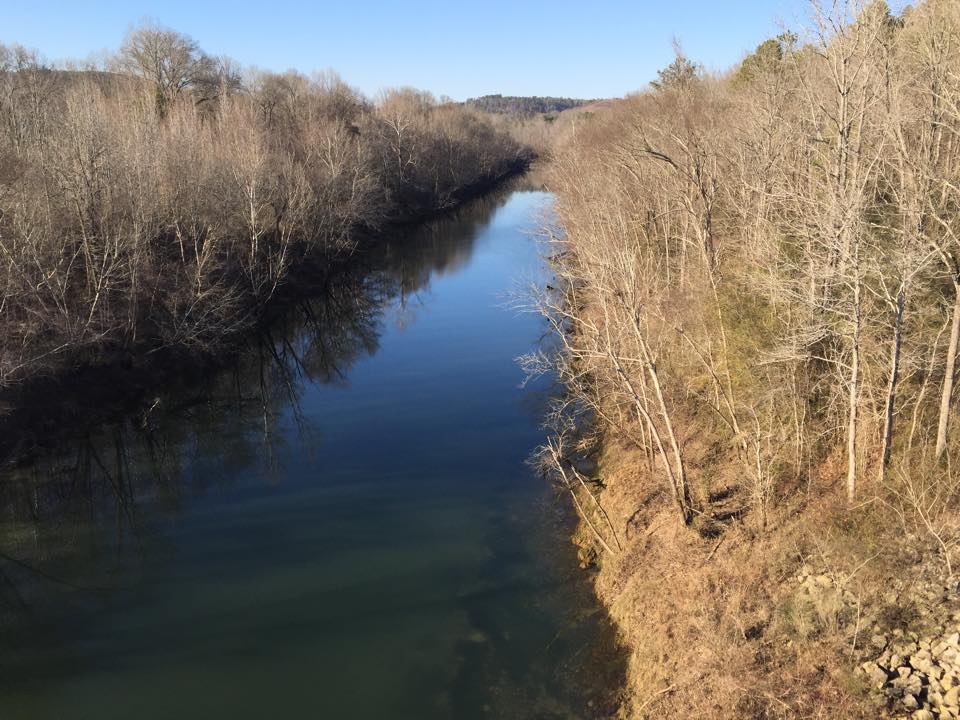
The Sipsey Fork originates at the confluence of Thompson and Hubbard creeks in southwestern Lawrence County. Often referred to by mistake as the Sipsey River, the Sipsey Fork is a tributary stream of the Mulberry Fork, which is part of the Black Warrior River. It flows south-southeasterly until impacted by the impounded waters of Lewis-Smith Reservoir. This section, commonly referred to as Upper Sipsey Fork, lies completely within the boundaries of the William B. Bankhead National Forest. Sipsey Fork is Alabama’s only stream classified as a “National Wild and Scenic River,” ensuring its protection for future generations.

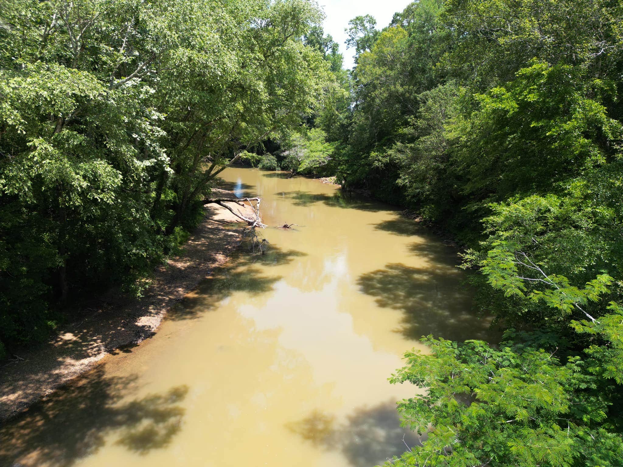
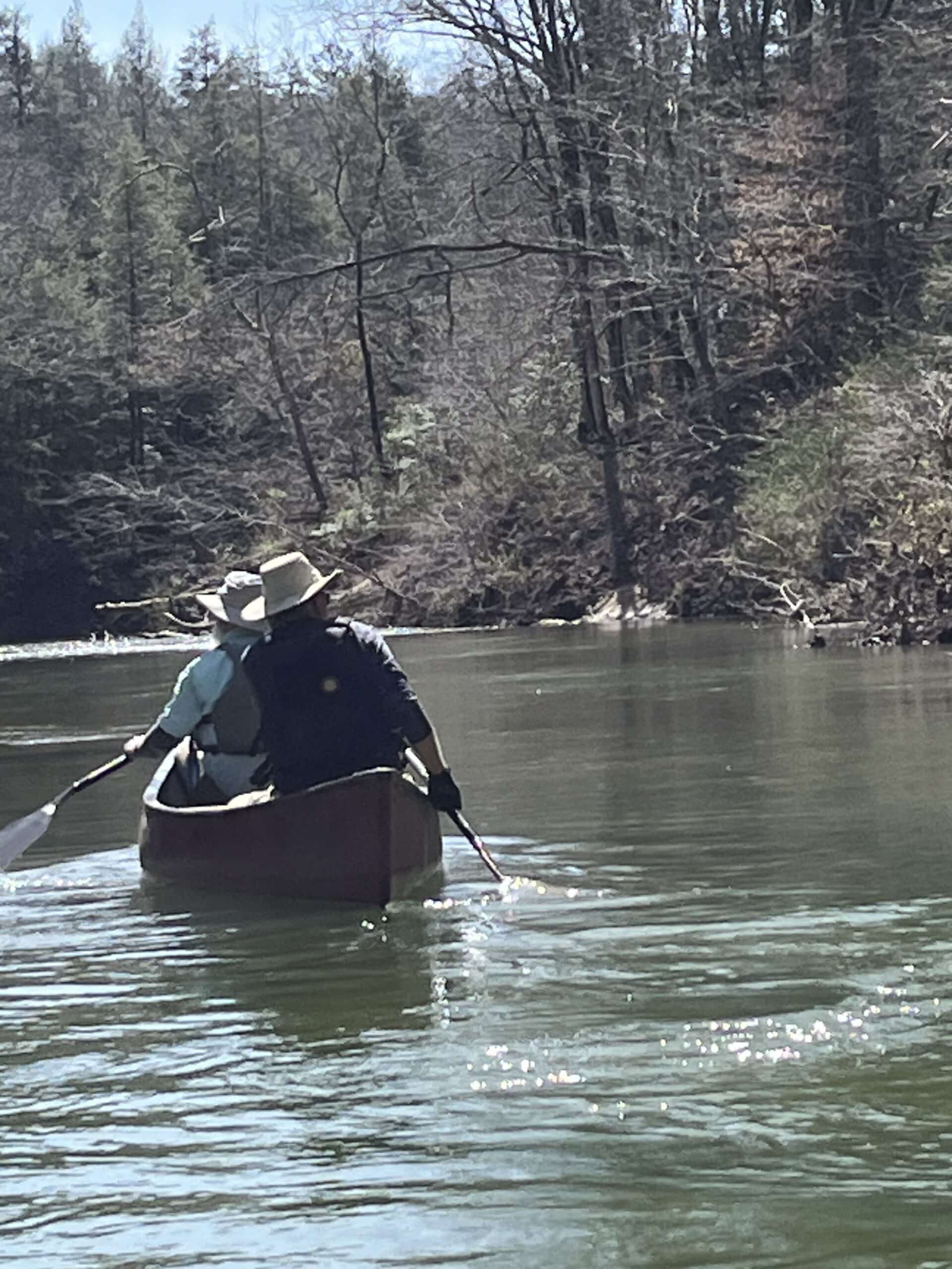
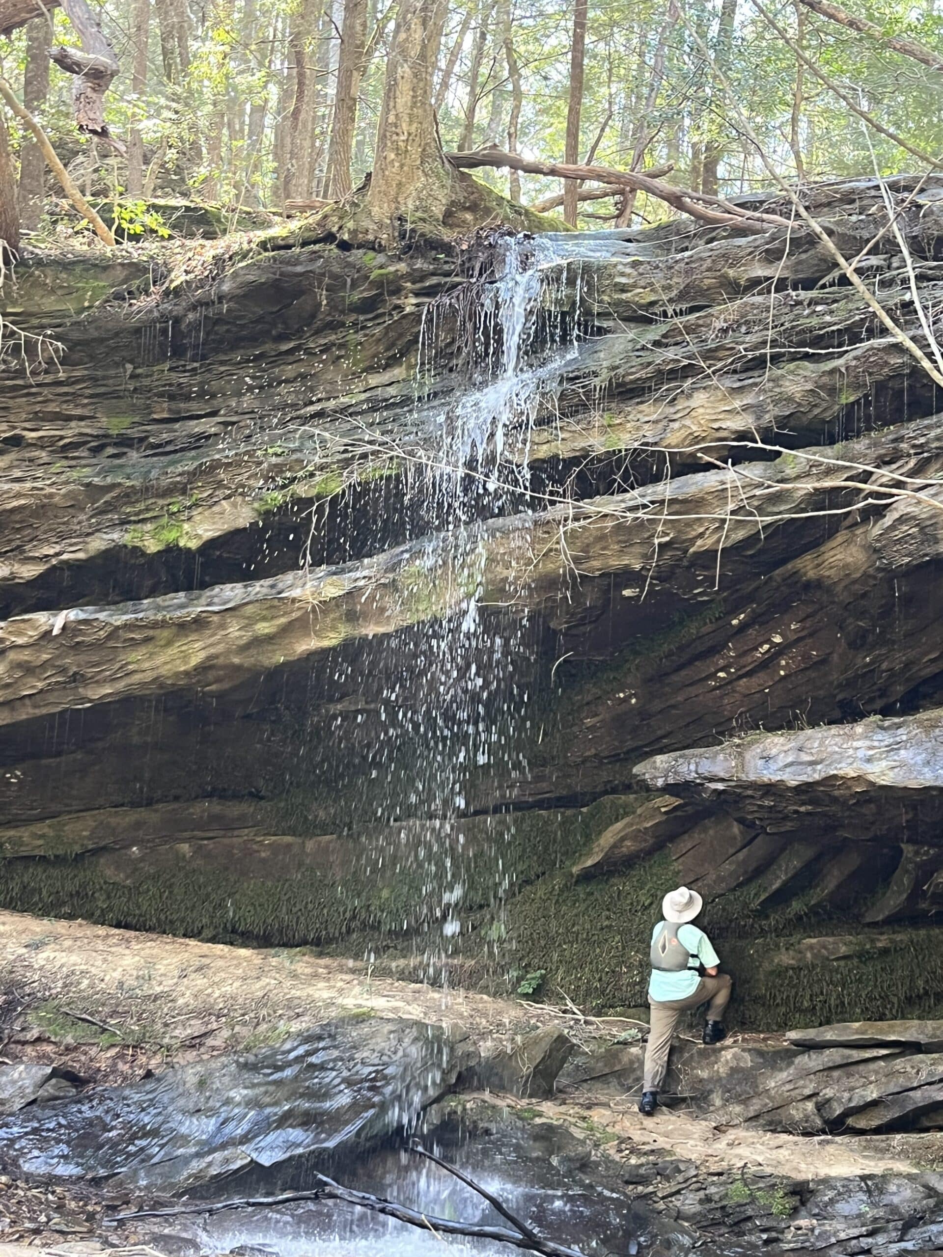
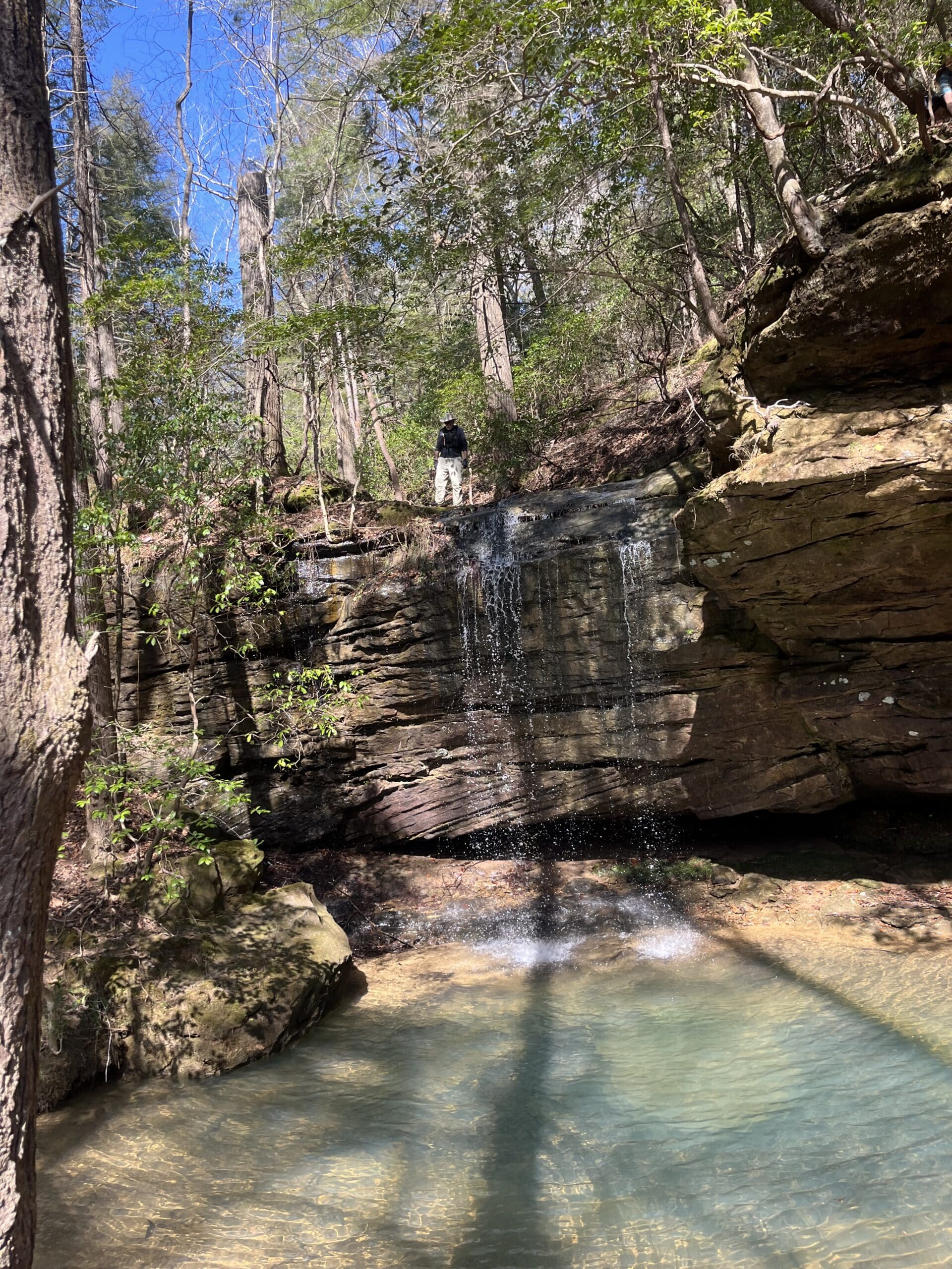
Floating Upper Sipsey Fork by kayak or canoe is the ideal method of enjoying its wonder. The aesthetic value alone makes the adventure worthwhile. Frequent rock bluffs rise straight up from the stream’s edge, some in excess of one-hundred feet. Lush vegetation drapes the shoreline, while the surrounding country is hilly, heavily wooded, remote, and quiet. The music of water cascading over the many cliffs is a guarantee in the Sipsey Wilderness nicknamed the “Land of a Thousand Waterfalls.”

Find out more about the Sipsey Fork Wilderness Area by learning about Bankhead National Forest.

Trip Summary

There are some who say the Sipsey Fork is Alabama’s most impressive paddling destination. The 71-mile-long river is formed by the junction of Thompson and Hubbard creeks in the Sipsey Wilderness of Bankhead National Forest. The river flows through deep forest, and past impressive cliffs, with waterfalls carving deep draws on the canyon sides. The most popular run, about 9.6 miles, is from the Sipsey Picnic Area on Cranal Road to the takeout near the Highway 33 bridge just north of Double Springs. Unfortunately, this is a trip that must be done in winter or early spring, as water levels drop in April and May to un-runnable levels. The trip is mostly moving water, with a few small shoals and one Class II rapid, called 100 Yard Dash.

Water Level Recommendations: Minimum water level for a trip that doesn’t involve scrapping over rocks or having to get out of your boat is around 80 CFS (cubic feet per second). At levels over 200 CFS, use caution at shoals and at 100 yard dash. Use the USGS gauge, “Sipsey River Near Grayson, AL” for reference.

Trail Highlights

Day 1

  • Stop 1: Put in at Sipsey Recreation Area
    • Coordinates: 34.285176, -87.399101, This put in is a part of the Bankhead National Forest and Sipsey Wilderness Area and has a fee of $3.00 per vehicle for day use.
  • Stop 2: Waterfalls and Side Canyons
    • There are multiple side canyons or draws on both sides of the river, many with waterfalls pouring over the top of the draw. Listen for the sound of falls and look for where the creek empties into the river. You can often hike up the draws to get a good look at the waterfall.
  • Stop 3: Lunch Spot
    • A popular lunch spot is on river left, where a side canyon has created a large overhang with a small waterfall. There is a flat area at the top with plenty of rocks to sit on while you eat.
  • Stop 4: The 100 Yard Dash
    • 100 Yard Dash is a Class II rapid. It’s about 6 miles from the put-in. As the name implies, it’s mostly a straight shot through a narrow spot where the river necks down. Listen for the roar of whitewater and look for large boulders on river left. The entrance to the rapid is on river right, and it’s a good idea to scout to be sure there are no trees down in the river. Stay in the center then ease to the left to miss a rock at the bottom.
  • Stop 5: Craney Creek
    • Depending on water level, you can usually paddle up Craney Creek, on river right, for several hundred yards to be rewarded by another waterfall dropping into the creek.
  • Stop 6: Take out on river left at the Sipsey Take Out, a short way below the Highway 33 bridge.

Side Ventures & Optional Activities to Add to Your Trip

There are several great options to add to your trip should you wish to expand this adventure.

  • Fishing:
    • Excellent fishing opportunities on the Upper Sipsey Fork for species such as bluegill, longear sunfish, green sunfish, spotted bass, and white bass.
    • The best, and perhaps only, place to catch trout in Alabama is nearby. The Sipsey Fork flows into Smith Lake, and continues on below the dam which forms the lake. The dam’s outflow creates an outstanding trout fishery.
    • Riverside Fly Shop is recommended as a great fishing guide for the area.
  • Hiking and Camping: Explore the numerous hiking trails and camping sites in Bankhead National Forest.
    • The Sipsey Wilderness, which is a part of Bankhead, abounds in hiking trails, many leading to waterfalls, including Craney Creek Falls, Sougahoagdee Falls and others.
  • Nearby Outfitters: Consider other outfitters for a different on-water trip nearby, like Bear Creek Canoe Run near Hackleburg for additional paddling adventures.

Bonus Sightings

  • Waterfalls:
    • The Sipsey Wilderness is known as the “Land of a Thousand Waterfalls,” with many falls cascading over cliffs and into the river’s side canyons.
    • The Sipsey Wilderness abounds in hiking trails, many leading to waterfalls, including Craney Creek Falls, Sougahoagdee Falls and others.
  • Fishing Opportunities:
    • Excellent fishing, particularly in April-May and October-November, for species like bluegill, longear sunfish, green sunfish, spotted bass, and white bass.
  • Wildflowers:
    • Abundant in spring, including trillium, mountain laurel, and various species of wild orchids.
  • Wildlife:
    • Common sightings include white-tailed deer, wild turkeys, beavers, kingfishers, herons, and occasionally bald eagles.
  • Bird Watching:
    • A variety of bird species can be spotted, adding to the rich biodiversity along the river.

Non-Paddler Recommendations

  • Looney’s Amphitheater Complex and Cultural Center in Double Springs:
    • Part of Winston County Arts Council, Looney’s Amphitheater offers various cultural and entertainment events throughout the year.
  • Explore Downtown Jasper, AL:
    • Discover the charm of Downtown Jasper. Use the interactive map to explore local shops and attractions.
  • Golfing in Moulton, AL:
    • Work on your golf game in Moulton. More information can be found here.

Share Your Trip!

Have you completed this trip? Share it with your friends, family, or colleagues!